Archaeological Route
The periods of history that have passed by the Sant Jordi d'Alfama have been varied. From the pre-imperial Roman, medieval times through to the creation of the Order of Sant Jordi Alfama, the construction of eighteenth century military fort and finally the civil war. This route takes in the areas of the Sant Jordi beach and its surroundings, and Marina Sant Jordi to visiting the stretch of Via Augusta and Rivellets to understand one of the building mechanisms of the anomenada via.
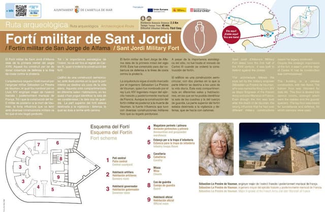
1. Sant Jordi Military Fort (Archaeological route)
Sant Jordi d’Alfama’s Military Fort dates from the first half of the XVIII century. It was built to defend against the pirates. The architecture follows the style set by the military engineer Sébastien Le Prestre de Vauman, who was named by King Lluís XIV as Major Engineer of the French Army and later Marshall of France. Even though the fort was built after the death of de Vauman, the strong influence that he had over different military constructions meant his legacy continued. Despite the strategic importance of the fort, it wasn’t until the reign of Carles III that its construction was commissioned. The building is a circular construction, with two floors. The bottom floor was intended for daily life. This floor is divided into various rooms, amongst which were the stables and the guards’ quarters. The top floor was meant for surveillance and defence, for which cannons were used.
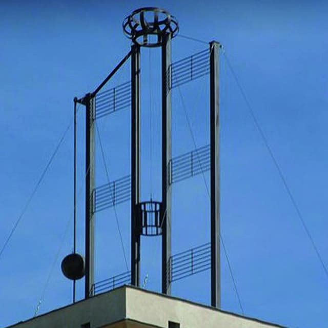
2. The Watchtower (Archaeological route)
The operation of these watchtowers were based on the Mathé code, which is a combination of six spheres mounted on their respective vertical bars located at the top of the tower and which could be seen from the next tower. Given the important strategic role of the telegraph, the lines and the towers were organised militarily according to province. Each tower had two operators and anassistant who worked shifts from dawn to dusk watching the previous and the next towers. The messages were generally of a military nature and were copied from tower to tower without the operators knowing their meaning. A complex encrypted language based on a code book was used and only the commander of the line knew the meaning. In the message the name of the page of the book and an alphanumeric code was sent giving reference to a word or expression.The distance between the towers varied between 10 and 15 kilometres; the fortified towers were square with three floors and reached 8.5 metres high. The base was 6.4m cube with a 95 cm thick wall, leaving an internal space of 4.3 x 4.3 metres. The lower floor didn’t have a door; access to the tower was via the first floor with a removable ladder in case of danger. The optical telegraph was made up of 4 metal panels arranged vertically forming a cross, each of them with three strips. They were separated from each other by a distance equivalent to three times the length of the indicator, which was a moving cylinder between the panels. On one side there was a ball which moved vertically and depending on its position in respect to the panel strips, indicated a code to the line service: damage, message interruption, priority, etc. The inner cylinder, or indicator, was moved with a graduated pulley located inside the tower. The position indicated a code relating to the information that needed to be transmitted. The stretch between Barcelona and Valencia consisted of 30 towers, and extended to the branches of Tarencón and Con· ca and the 17 Junquera towers. This tower is number 48 in the series. Although its construction lasted until 1850, the tower was never operational, although the branches València-Castelló and Barcelona-Tarragona worked on an unofficial level.
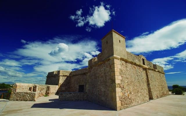
3. Sant Jordi Military Fort (Archaeological route)
After the defeat of the Arabs in Tortosa at the hands of Count Ramon Berenguer IV, the land and the coast of the Alfama desert were not a safe passage for the new conquerors or the Christian settlers. They were constantly attacked, by land and sea, by the crews of the Saracen ships which often took shelter in the bays along this coast. Peter II devised and founded the new order for the protection of the coastal land. The Order of Sant Jordi d’Alfama was founded in 1201; at the same time the King took possession of land and property of the Templar Joan d’Almenara, who acted as the Royal Chaplain and Administrator in charge of raising funds for the construction of the fortress. The castle endured moments of plenitude and misery over three hundred years. During the time of the Catalan Revolt in 1650, the Castilian Ships shot through the walls of the old castle thereby not allowing the French, who had just been driven out from the city of Tortosa, to use the castle.
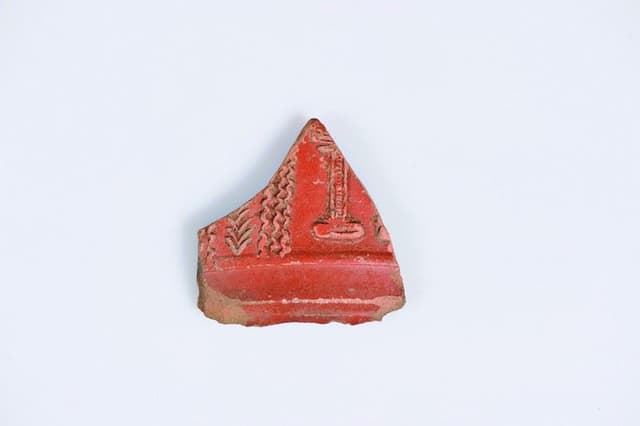
4. Ancient History of the Area (Archaeological Route)
The area in question has, since ancient times, been an important strategic location. Many signs indicate the importance of the spot even before the colonisation of the Roman Empire. The area of Sant Jordi d’Alfama presents geomorphologic characteristics which make it especially attractive to sailers. The presence of a piece of land that juts into the sea, linked to the presence of freshwater springs, (as the name Alfama indicates - derived from Arab meaning water safe to drink) and the fact that Via Augusta passes through the area, makes it a perfect place for commercial sailing. Several signs, such as the presence of ceramic materials on the surface, fragments of tableware from the Campanian production, coins and other items, and especially ruins of the amphorae from the Republican period, show a continuous occupation between the III and II centuries BC and until the last quarter of the I century AD, with an intermittent presence during the lower Roman Empire. To understand the activity better we must look at in the context of the wider territory. The existence of an ancient road linking Gavadà with the town of Tivissa and the Ebro area, suggests that the site acted as a loading and unloading point for ceramics manufacturers in Aumedina in Tivissa.
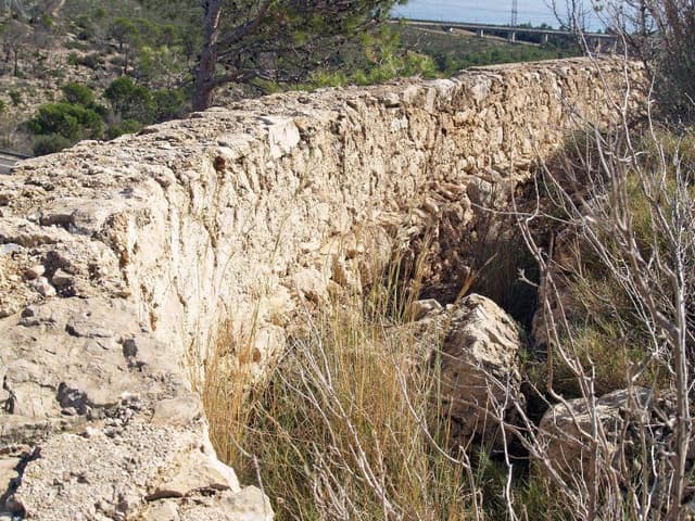
5. Via Agusta (Archaeological Route)
...
...
